AIDA - From Airborne Data Inversion to In-Depth Analysis
A multi-approach project to reveal subsurface structures of the Earth sponsored by the GEOTECHNOLOGIEN programme of BMBF and DFG: "Tomographie des nutzbaren Untergrundes - Von der Durchschallung zum Echtzeitmonitoring"
Our aims
The aim of the joint research project is to generate end-user oriented information from geophysical measurements that are properly transferred from physically quantitative descriptions of the subsurface, such as electrical conductivities, densities, susceptibilities etc. into spatial structures and matching the understanding of the clients. Those may be structural geologist, hydrogeologists, engineers and many others. This transfer shall be supported by automatic numerical methods, a realistic 3D-visualisation and a proper understanding of the underlying processes that account for 3D-spatial structures. The closer we get from depth to surface, the larger and denser are the different sorts of use in respect to economical needs and the availability of geo-information. For this reason, we strive for revealing near subsurface characteristics in great detail.
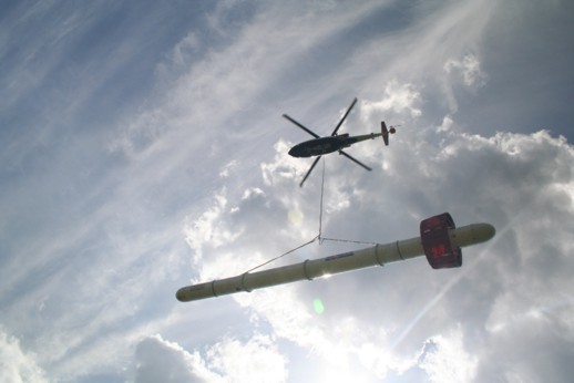
 HEM bird under BGR helicopter
Source: BGR
How to get there?
In order to achieve this goal, the project partners mainly use already existent survey data that is characterised by a dense coverage of airborne and ground geophysics as well as by borehole information, seismics etc. These regions are representative for chosen economic areas in order to develop a much improved applicable insight in 3D-structures of the subsurface and to be able to quantitatively describe intrinsic dynamic processes via improved, iterated project feedbacks using new techniques and inversion schemes, tested for plausibility.
Since especially airborne geophysics covers large areas in short time and high precision and follow-up ground based measurements can reveal important details, adequate data sets from BGR and partners are used for such investigations. The goal is to optimise even more the processing, inversion and interpretation of already optimised airborne and ground-based measurements. Exploration industry increasingly employs airborne geophysics for regional and local surveying. This project aims to give the German industry a large benefit by the development of much improved data processing techniques.
Contact 1:
Contact 2:


